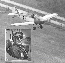
I had to get something from the hangar, for my son, so I went early and had a nice late afternoon flight, for almost 1 hour. It was about 70 degrees with a gentle breeze down the runway. I left the traffic pattern for a while and flew around south of the airport.
Coming back I noticed this pipeline running north, east of the airport. They keep a wide path clear so they're easy to find and follow. They're also shown on the sectional charts. Them, high power line clearings and expressways are great navigation aids when traveling in these tree covered states down south.
The airport is between me and Merry Mountain.
Here's a closeup of the white book warehouse north of the airport. If you zoom in and look in front of the strut, and above the spreader bar, you can see Orange County Airport. It's not the white buildings just above the bar but the tiny ones above then. OK, I know what I'm looking for. It's about 6 miles north.
I mentioned the mountains on the west side of the traffic pattern the other day. Here's what Merry Mountain looks like at traffic pattern altitude on the crosswind for runway 5.
This is it after turning downwind for runway 5.
Looking south was hazy from smoke that came from somewhere way south of us.
Looking north over the runway, with the sun behind me, you don't even see the haze.


