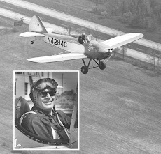
Yesterday evening was clear with a light southeast breeze so I head south toward my brother-in-law's farm near Kents Store, about 30 miles.
Fall colors are starting to change. On the ground it looks like we're into fall colors, not so much from the air.Below, Under the tip of the spreader bar is one of 2 quarries in the US which mine Vermiculite.
I hadn't seen this huge Solar Farm before, in front of the wire on the right wing. It's about 5 miles west of the town of Louisa, which is under the spreader bar on the left wing.
After flying about 1/2 hour I realized I was over a school and I didn't have a clue where exactly I was, but I was east of where I should have been. I could see the water tower at Louisa so I just headed back northwest and on to Gordonsville.
Here's the aerial image from Google Earth. The school turned out to be Jouette Elementary school, lower right, way east of Mike's farm on Four Winds Lane, lower left. Louisa is in the middle at the top.


No comments:
Post a Comment